|
| Yield Goals for 2019 |
|---|
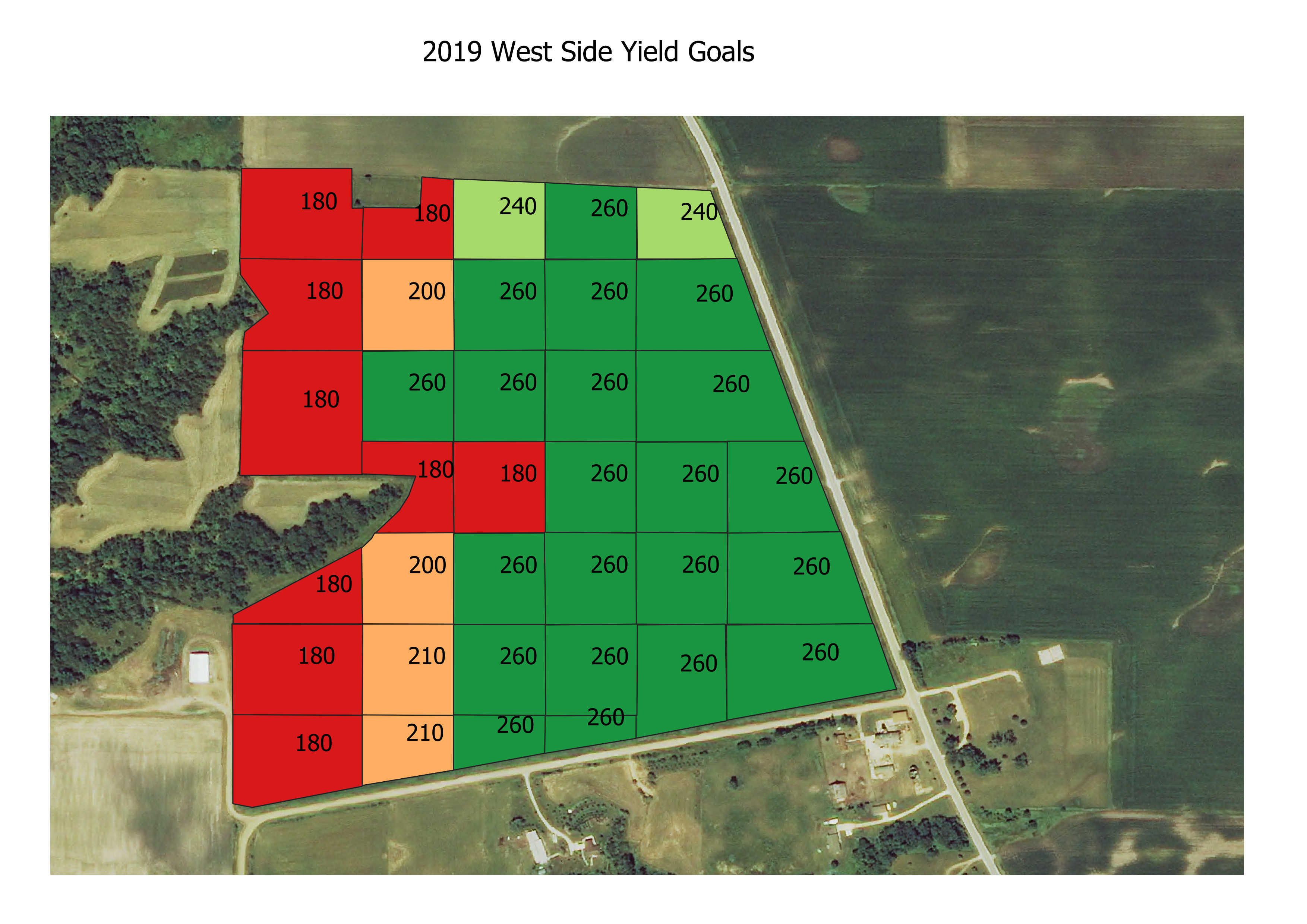 My corn yield goals were assigned based on things like previous yields, soil types and quality, slope, and drainage. |
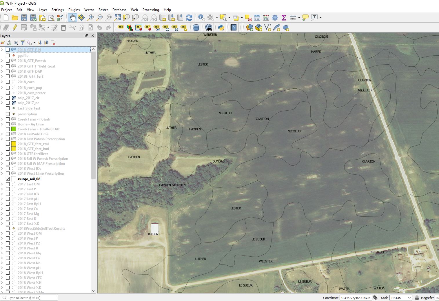 This was done with QGIS mapping software looking at soil types... Nicollet, Webster, and Clarion have high CSR2s and are excellent soils. Hayden, Luther have low CSR2s and are poorer soils and will yield less. |
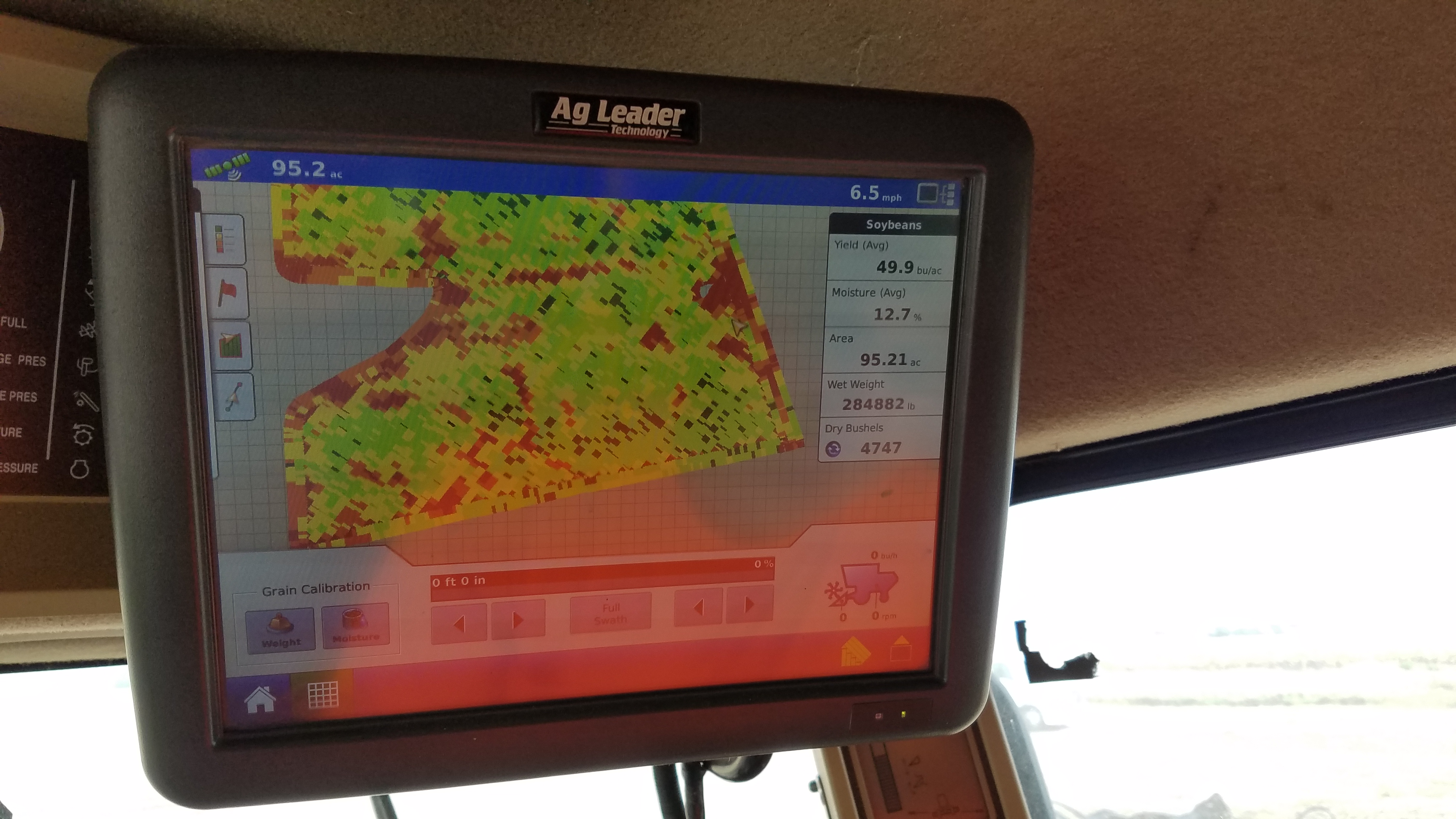 I also use knowledge of the field including yield maps from the combine. Dark green areas have highest yield. Yellow lower. Red is lowest. Data from the yield monitor was transfered to my QGIS mapping software. |
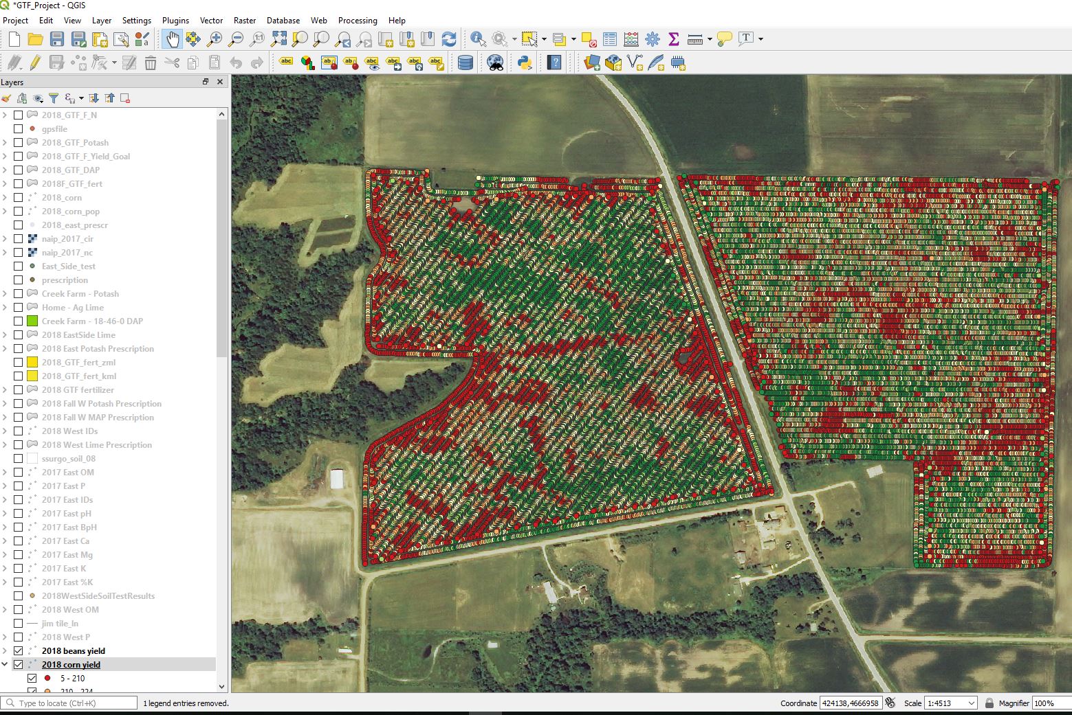 With QGIS mapping I can query individual areas for yields. |